
BRINNON — Lake Constance lives up to its reputation as the hardest hike on the North Olympic Peninsula.
It’s brutal.
Few well-established routes are as steep or technically challenging as the 6.3-mile approach to this subalpine lake in the Dosewallips River drainage in east Jefferson County.
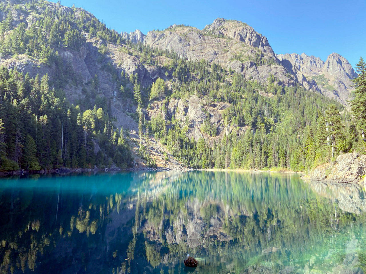
The turquoise tarn is nestled in a 4,780-foot cirque below the cliffs of 7,786-foot Mount Constance in Olympic National Park.
An alpine glacier deposited large blocks of rock along Constance Creek in the Dosewallips River basin. (Rob Ollikainen/Peninsula Daily News)
A Saturday ascent exceeded expectations and confirmed online reports that the hike should not be taken lightly.
The meat of the climb begins after a relatively flat, 4.1-mile trek up the Dosewallips River on an old roadbed. The warm-up can be hastened with a bicycle if you don’t mind carrying the bike around a 200-yard wash-out.
A sign at the bottom of the climbing route points to the right and says: “Extremely steep. Infrequent maintenance.”
They weren’t kidding.
You will gain a whopping 3,380 feet in the next 2.2 miles, hurdling dozens of fallen logs on the lower slopes and holding onto roots and marine basalt for safety on the more treacherous upper pitches.
The national park describes Lake Constance as a route instead of a trail, and for good reason.
Certain sections require handholds and careful foot placement. Red metal markers and pink ribbons are used to stay on course.
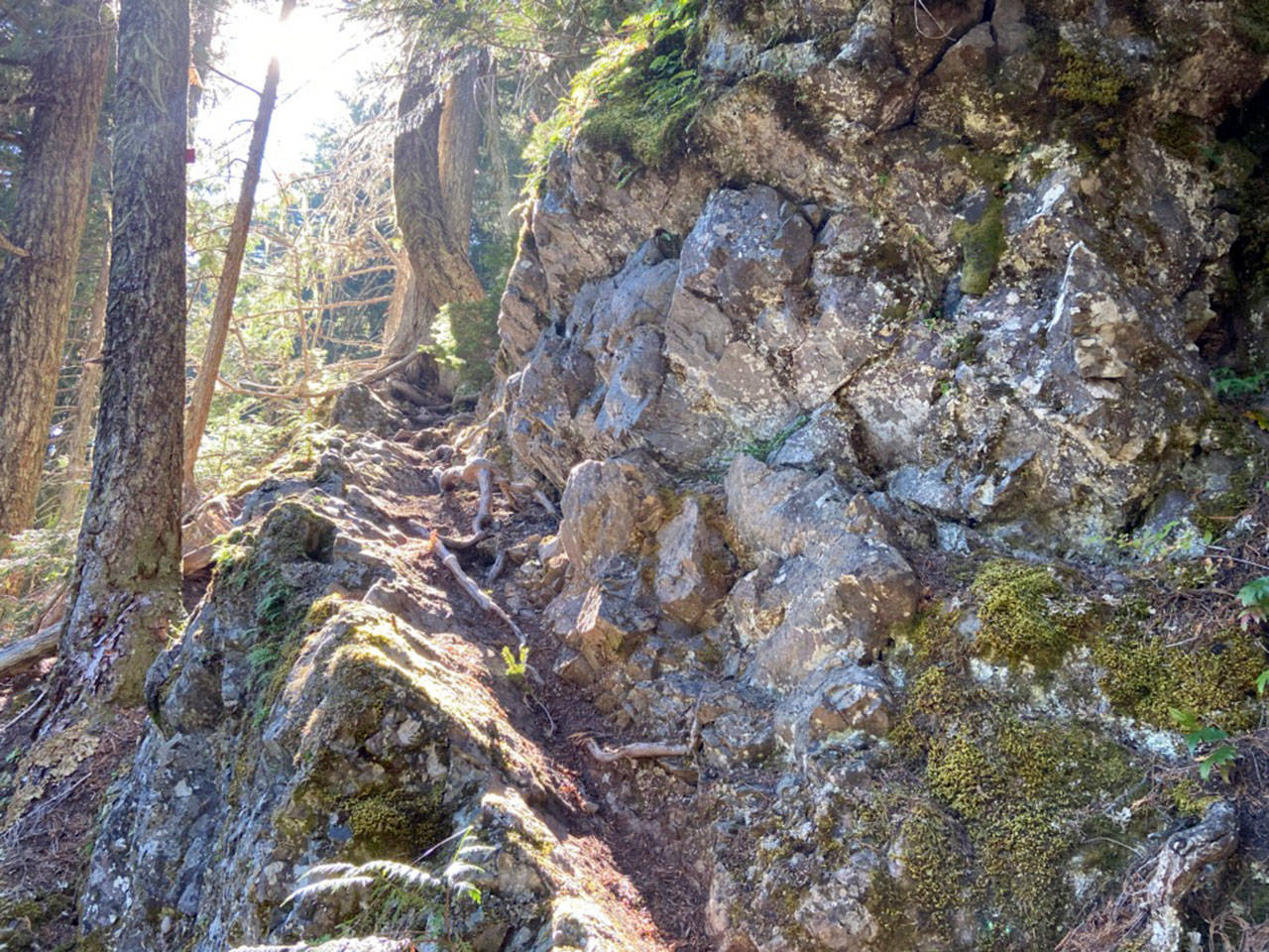
A rock ledge leads the way to Lake Constance. (Rob Ollikainen/Peninsula Daily News)
While the hike is considered a Class 2 and sometimes Class 3 scramble, non-rock-climbers can safely access the lake by taking it slow and maintaining three points of contact.
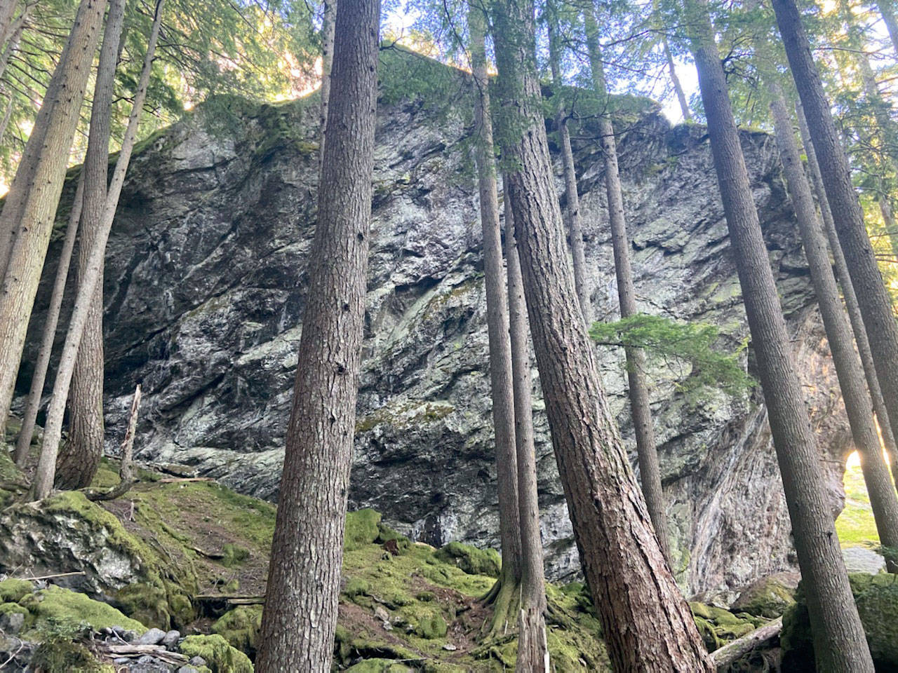
The lower third of the route was burned in a 2009 forest fire. The middle third follows subterranean Constance Creek up a forested canyon scattered with massive boulders. The creek reemerges on the upper third of the ascent before Lake Constance emerges through the trees.
Several campsites are available at the fish-stocked lake. Reservations are recommended.
Mount Constance, the basalt massif looming above the lake, is the most visually-prominent Olympic peak on Seattle’s western horizon.
It looks even better up close.
________
Reporter Rob Ollikainen can be reached at rollikainen@peninsuladailynews.com.