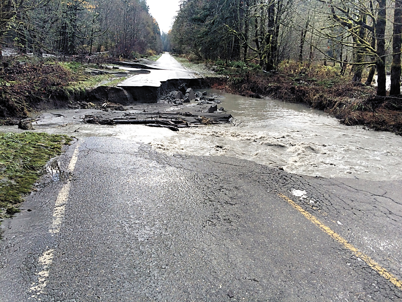
OLYMPIC NATIONAL PARK — The Elwha River flexed its new muscles during the most recent round of storms and severely damaged Olympic Hot Springs Road and effectively buried a campground in silt.
The river rose to 23.19 feet on Nov. 17 during a heavy rainstorm that produced 5.6 inches of rain on that date in the Elwha watershed, as measured at the Buckinghorse Snotel site.
When the water receded, Olympic National Park officials discovered the water had washed out a 60-foot-long section of Olympic Hot Springs Road, and much of Elwha Campground had nearly disappeared under more than a foot of silt and debris, Barb Maynes, spokeswoman for the park, had said over the weekend.
“The washout was caused by a flooded side channel,” Maynes said Sunday.
Flood stage for the Elwha River is 20 feet, “moderate flood stage” is 21.5 feet and “major flood stage” is 23 feet, as measured at the McDonald Bridge south of the campground.
It is the highest the river has reached since the Elwha and Glines Canyon dams were removed, and the seventh highest crest recorded, according to National Weather Service records dating back to the late 1800s.
The highest crest recorded at the site was 24.65 feet in 2007, Weather Service records showed.
“Other areas in the [Elwha] valley have seen damage — extensive damage,” Maynes said.
“Park staff is still assessing the damages,” she said.
Maynes said there is no established timeline yet for repairs or reopening damaged Elwha roads and campgrounds.
Elwha River valley attractions and roads have been opened and closed several times over the past few years due to dam removal, washouts and floods.
Olympic Hot Springs Road south of Altair Campground was closed for three years while crews removed the Glines Canyon Dam.
It reopened in November 2014 and provided access to the west Glines Canyon overlook, a remnant of the former dam, and to the Olympic Hot Springs Trail.
Altair Campground has been closed since December 2014 due to road and campsite damage during floods.
A storm in January caused a slide on the nearby Whiskey Bend Road that destroyed 50 feet of roadway.
Park crews completed repairs at the slide, located about 4 miles from the road’s intersection with Olympic Hot Springs Road, and it was reopened Oct. 30.
The road provides access to the east Glines Canyon overlook.
A February flood resulted in damage to the Olympic Hot Springs Road near the Madison Creek Falls trailhead, where the road was closed for several weeks in September for repairs.
The road repair, called “rootwad revetments,” used natural materials to reduce erosion by burying downed trees with their roots exposed to the stream, with boulders, rock and gravel securing the tree trunks under the new roadbed.
September’s repairs to both roads survived the most recent storm and flood, Maynes said.
Elsewhere in the park, Queets, North Shore Quinault, Graves Creek and North Fork roads remained closed Sunday due to storm damage.
As of Sunday, the Kalaloch, Mora, Ozette, Hoh, Lake Crescent and Staircase areas were accessible.
The Hurricane Ridge Road and the Sol Duc Road remain closed Sunday due to snow.
The park reported 21 inches of snow at the ridge.
Snow plow operations on Hurricane Ridge Road are expected to begin Friday to open the popular destination for the winter season.
The road is scheduled to be open during daylight hours Fridays through Sundays and Monday holidays, weather permitting.
All vehicles must carry tire chains when traveling to Hurricane Ridge during winter.
Hurricane Ridge Ski and Snowboard Area has not yet scheduled an opening date.
________
Reporter Arwyn Rice can be reached at 360-452-2345, ext. 5070, or at arice@peninsuladailynews.com.
Reporter James Casey can be reached at 360-452-2345, ext. 5074, or at jcasey@peninsuladailynews.com

