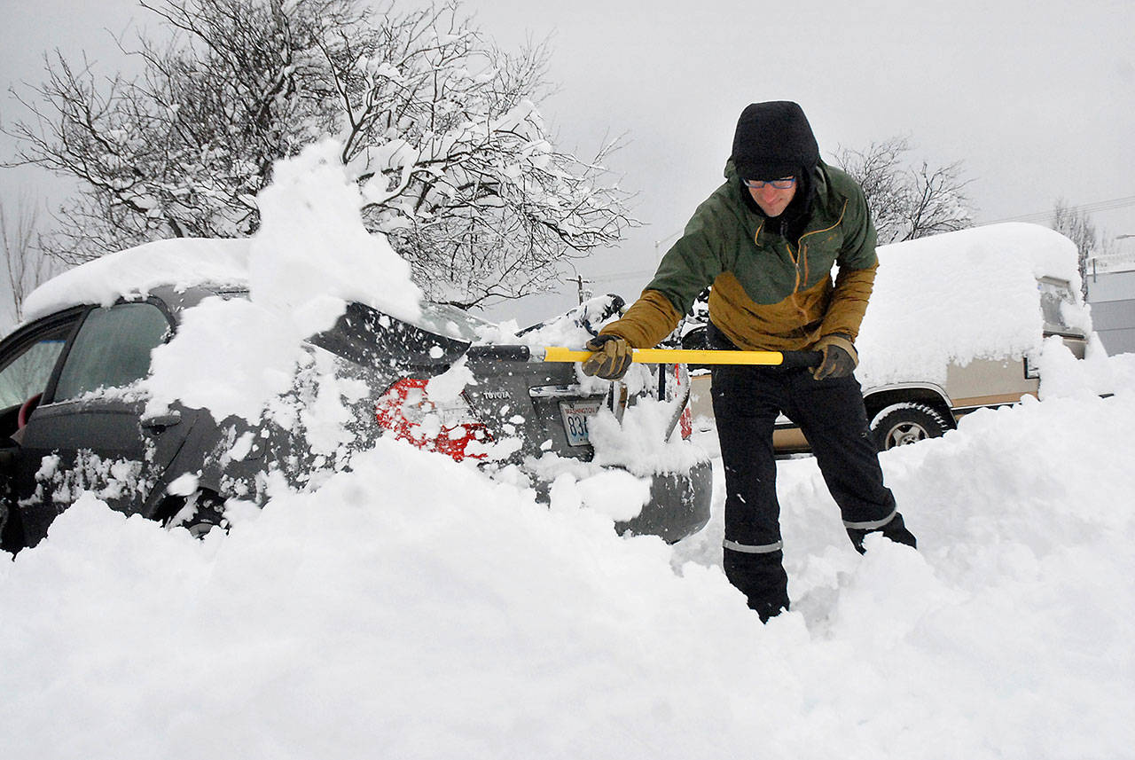
PORT ANGELES — A slow-moving snowstorm blanketed the North Olympic Peninsula late Tuesday into Wednesday, inundating the Port Angeles area with about 1 1/2 feet of snow, the National Weather Service said.
Area schools and many businesses were closed Wednesday as road crews worked around the clock to plow the main arterials.
“Right now, people appear to be behaving,” Clallam County Undersheriff Ron Cameron said Wednesday.
“There just isn’t a lot of calls coming in. We’ve been pretty fortunate that way.”
New snowfall totals in Port Angeles ranged from 15.2 inches near the Strait of Juan de Fuca to 20.2 inches in the higher elevations, according to the Community Collaborative Rain, Hail and Snow Network.
Port Angeles had more snow than any other populated area in Western Washington, said Kirby Cook, a meteorologist with the National Weather Service in Seattle.
“You guys were the big winner yesterday, unfortunately,” Cook said Wednesday.
“You guys caught the brunt of it.”
The Sequim area had between 5.6 and 8.0 inches of new snow. An official reading from the Forks area showed 5.5 inches.
“The snow that you’re seeing is pretty heavy from Port Angeles west to Joyce,” Cameron said while staffing the county’s Emergency Operations Center on Wednesday morning.
“Clallam Bay seemed to have got hit pretty good. Forks not quite as much, and Sequim not quite as much.”
Cold air from the Fraser River Valley pushing upslope against the Olympic Mountains contributed to the higher accumulations along the central Strait, Cook said.
“We had that band of heavier precipitation that moved in from east to west across Western Washington,” Cook said.
“It was basically, for the most part, parked over the northern Olympic Peninsula. Everything was in the right spot to produce a fair amount of snow in the Port Angeles area.”
Cook added that Port Angeles could seen another inch of snow by Thursday morning, with greater accumulations forecast for the Hood Canal.
Clallam County Public Utility District reported 624 outages in the Sequim area as of 2:20 p.m. Wednesday as easterly winds increased.
Power outages were relatively sparse Tuesday evening into Wednesday, Cameron said.
“Forks kept their power, so everybody stayed warm,” Cameron said after an emergency management briefing at the ECO.
Port Angeles City Hall was closed Wednesday.
Olympic Medical Center and the Clallam County Courthouse remained open.
Peninsula College’s Port Angeles campus is closed Thursday, as are Port Angeles, Sequim and Crescent schools.
The Clallam County Sheriff’s Office had received about 15 snow-related calls for service by late Wednesday morning — vehicles in ditches, trees down — but no reportable or injury-related collisions, Chief Criminal Deputy Brian King said.
There had not been any injury accidents on state roads, either, he added.
“As far as county roadways go, we urge people to stay at home and not attempt to drive in these conditions,” King said.
State Patrol Trooper Chelsea Hodgson, agency spokeswoman, reported multiple spin-outs and vehicles in ditches but no major collisions.
Hodgson tweeted Wednesday a reminder for motorists to slow down and stay alert in winter weather, “or better yet — just #StayHome.”
Cheryl Scartozzi, assistant project engineer with the state Department of Transportation, said the road maintenance office crew had been continuously plowing overnight on U.S. Highway 101 and adjacent roads, with 18 trucks out.
“We brought another four [trucks] in from an adjacent district,” Scartozzi said.
A slow, gradual warming was forecast for the remainder of the week, helping to assuage flooding concerns.
“Right now, we’re not expecting flooding,” Cook said. “Having said that, you guys could see a lot of slush, especially in areas not getting draining.”
The forecast highs for Port Angeles were 40 degrees Thursday, 39 degrees Friday and 45 degrees Saturday. Low temperatures were forecast to remain in the upper 20s and low 30s until Saturday.
“It helps to get that sort of refreeze overnight,” Cook said. “It does look like a gradual warm-up, so that’s going to help.”
Cameron said the February 2019 snowstorm, which produced about three feet of snow in higher elevations near Sequim, was “much more widespread” than this week’s weather.
“Here, it’s real localized,” Cameron said.
“It’s significant, but it’s very isolated.”
Jefferson County
About a foot of snow blanketed the southern parts of East Jefferson County and shut down several area roads.
South county was hit the hardest by the winter storms overnight Tuesday and into Wednesday with an estimated 12 to 18 inches of accumulation near Brinnon and Coyle, said Matt Stewart, the county’s road maintenance superintendent.
Forecast
Today into tonight, gusty winds will ease, according to the National Weather Service. There will be scattered rain showers across areas, which might mix with snow at about 500 feet tonight, but accumulation is not expected.
We’ll see some minor tidal overflow that will affect locations in inland waters.
Refreezing conditions are possible during overnight hours tonight into early Friday morning.
The next system moves onto the Peninsula on Friday evening. Winds will increase along the coast and inland waterways, but not as strong as Wednesday.
Accumulations — if any — will be highly variable based on location of showers, surface temperatures and snow level. Snow levels are expected to rise from 500 feet to 1,000 feet Friday night to above 4,000 feet Saturday.
There is a chance of a flood threat Saturday on the Peninsula, as temperatures and snow levels continue to rise.
________
Reporter Rob Ollikainen can be reached at 360-452-2345, ext. 56450, or at rollikainen@peninsuladailynews.com.
Digital Content Editor Laura Foster, senior staff reporter Paul Gottlieb and Jefferson County Managing Editor Brian McLean contributed to this report.

