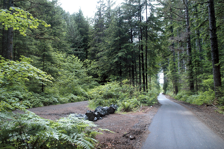
A newly paved section of the Olympic Discovery Trail beckons in the scenic Sol Duc Valley.
The multipurpose trail follows an obvious railroad grade through towering Douglas firs for much of a 7-mile leg between the Camp Creek and Mount Muller trailheads off U.S. Highway 101.
The recently completed section offers a wilderness experience with sweeping views of the Sol Duc River and surrounding hills.
Clallam County Transportation Program Manager Rich James said he hopes the public will “go out and try it.”
“It’s ready to use,” he said.
“It makes a nice 14-mile round trip.”
Bicyclists of all abilities will have no trouble riding along the flat railroad grade through a mature second-growth forest heading east from the Camp Creek trailhead.
Forest Service trailhead
The U.S. Forest Service trailhead is off Copper Ranch Road just south of U.S. Highway 101 — across the highway from Klahowa Campground near Milepost 212.
Riders might break a sweat towards the east end of the Sol Duc route where the trail leaves the railroad grade and traverses up a hill to a paved Merrill & Ring road.
Clallam County has a long-term easement with Merrill & Ring to use the forest management company’s road and bridge over the Sol Duc River.
East of the bridge, the marked Olympic Discovery Trail follows Forest Service Road 2918 to U.S. Highway 101.
The county acquired the 0.86-mile shared section of the federal forest road in January 2013 to expand the Olympic Discovery Trail.
The Mount Muller trailhead is north of the highway across from Forest Service Road 2918.
Eventually, cyclists and other users of the Olympic Discovery Trail will be able to travel from Admiralty Inlet in Port Townsend to the Pacific Ocean at LaPush.
More than half of Clallam County’s 70-mile portion of the trail is finished, including segments between Port Angeles and Blyn.
Other segments are being designed and built around Lake Crescent and points west.
The eastern quarter of the trail will extend some 27 miles from Blyn to Port Townsend. Of this, 7.8 miles are completed trail, and 19 miles are temporarily routed on paved roads, the Peninsula Trails Coalition says at www.olympicdiscoverytrail.com.
Sol Duc route
Most of the Sol Duc route — 5.4 miles — is a dedicated trail with smooth asphalt atop a bed of crushed rock.
The trail has a buffer of gravel on the side of the 8-foot-wide paved surface.
On the short road sections, multiple signs advise trail users to watch out for log trucks.
Clallam County hired Jordan Excavating of Port Angeles last year to build the Sol Duc segments of the Olympic Discovery Trail.
Federal funds accounted for 86 percent of the nearly million-dollar project.
Volunteer crews handled ancillary tasks and will help maintain the trail.
The Peninsula Trails Coalition plans to restore the deck of a rough wooden bridge along the Sol Duc route this summer.
Although trail advocates are familiar with the Sol Duc leg, James said the general public is not aware it exists.
A Thursday ride confirmed his theory: not a single passer-by in 14 miles.
“Not many people know about it,” James said.
Heading west from the Camp Creek trailhead, cyclists can avoid U.S. Highway 101 by taking lightly traveled Cooper Ranch and Mary Clark county roads all the way to Sappho.
East of the Sol Duc route, cyclists can follow the highway for 2 miles and regain the Olympic Discovery Trail at a well-marked crossing.
Clallam County is working with the U.S. Forest Service to link the 2-mile gap between the Sol Duc and Lake Crescent segments with a dedicated trail south of the highway.
________
Reporter Rob Ollikainen can be reached at 360-452-2345, ext. 5072, or at rollikainen@peninsuladailynews.com.

