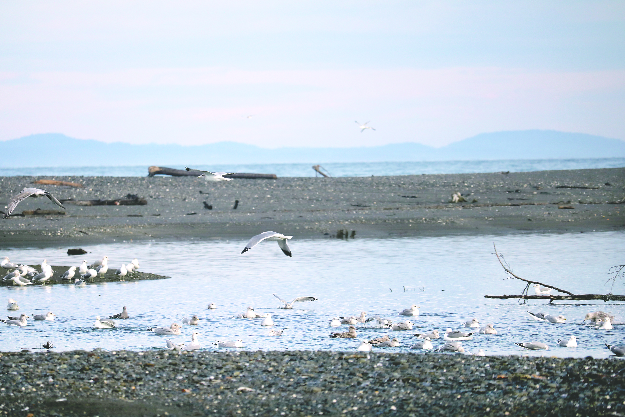
PORT ANGELES — Who owns the more than 80 acres of new sandy beaches at the Elwha River mouth?
Research and discussion have just begun about who owns, and who is responsible for maintaining, the land at the mouth of the Elwha River that was created by sediment washing down the river after two dams were removed.
The lowest portions of the beach belong to the state Department of Natural Resources, which controls all land lower than about 6 feet of elevation that is adjacent to waterways, said Dave Parks, DNR senior resource scientist and hydrogeologist.
The Lower Elwha Klallam tribe owns land on the east side of the river and some on the west side. How much of the new land belongs to the tribe is in question.
Private property abuts the accredited land on the west side, and access is through private property.
Surveys remain to be done and legal questions remain regarding the beach properties, Parks said.
“It’s a complicated issue with multiple ownerships,” he said.
No one has yet officially measured the new beaches, which keep changing, shifting with tidal changes, floods and additional sediment flowing downriver. Estimates of the amount of new land range between 80 and 100 acres.
Joe Smillie, spokesman for DNR, said Thursday that the state agency is working to determine exactly where the property lines exist on the new beaches.
The question has become more urgent as the number of visitors drawn to the beaches has grown.
Visitorship has exploded since the beaches took an exponential leap in size in 2013, according to Chuck Janda, former head ranger at Olympic National Park, who is caretaker for adjacent land owned by Malcolm Dudley.
On some warm, summer days, the beaches have drawn hundreds of people, he said.
“It’s one of the only sand beaches on the Strait of Juan de Fuca,” said Arnold Schouten, a member of the Olympic Peninsula Chapter of the Surfrider Foundation and an avid surfer.
The human influx prompts questions not only of ownership but maintenance, parking and access.
Volunteers
At the parking area on Place Road is a single portable toilet for sanitation.
That was set up and is maintained by Surfrider Foundation volunteers, who also provide a waste container for dog droppings,
But the ever-increasing number of visitors is overwhelming volunteer efforts, Schouten said.
He hopes the volunteers’ work will be temporary and that an agency will take over maintenance.
Access
Access to the new land on the west side of the river is from a county road, Place Road, where there is only one path to the beach and limited parking.
Private homeowners allow public access to the beaches through a trail along a dike built in 1962 on private property owned by Dudley.
The dike is maintained by the Army Corps of Engineers.
During the summer, Place Road can be jammed with traffic as people flock to the area — some of them surfers, some people on tour buses or school buses, some just out for a walk on the beach.
Schouten has seen beach visitors parked on the side of the road far west of the limited designated parking spaces tucked between the county road and the bluffs to the south and set just across the narrow road from private homes.
Homeowners are concerned about congestion on the road, Janda said, adding that they also want to keep all-terrain vehicles off the beach.
They have been patient, Janda said, and want to maintain public access to the new beaches, but they also want some controls.
For the most part, visitors have been polite, but occasionally beachgoers will go right up to a home and knock on the door, Janda said.
Clallam County
Place Road and access to the levy is maintained by Clallam County Road Department.
The narrow road and bluff to the south create physical limits to improving parking access, Ross Tyler, Clallam County engineer and head of the road department, said Thursday.
County officials will have to meet with homeowners to determine how to address the parking problems, Tyler said.
A more immediate need is to replace the antiquated bollards currently restricting access to the dike, he said.
Tyler said several beach fires set by visitors in piles of driftwood have revealed a need for emergency vehicle access to the beach, and several cars have managed to bypass the bollards and had to be towed out.
Tribal lands
The land above 6 feet elevation on the east side of the river belongs to the Lower Elwha Klallam tribe and is accessed through tribal lands.
No public access is provided to those beaches on tribal roads; the roads are clearly marked for tribal access only, said Robert Elofson, river restoration director for the tribe.
Everything east of the river is part of the Lower Elwha Klallam Tribal Reservation, which has not had to concern itself with public interest before, Elofson said.
“Before the dams came out, it was just big cobbles and a steep beach,” he said.
Currently, access via Charles Road and a small parking area near the beach is granted on request, he said, usually with a tribal escort.
Elofson said the beaches have grown so much that what was once a short walk from the parking area and turnout is now a three-fourth-mile hike across sand to the river mouth.
The tribal council is considering options for establishing public access to the beaches in a sustained manner, he said.
The county road department works in cooperation with the tribe to maintain roads on the reservation and may need to work with the tribe to determine what, if anything, needs to be done with the roads leading to the tribal beach access sites, Tyler said.
The current roads are very old and have had little maintenance, he said.
________
Reporter Arwyn Rice can be reached at 360-452-2345, ext. 5070, or at arice@peninsuladailynews.com.

